United States dollar
$
The United States dollar (symbol: $; code: USD; also abbreviated US$ or U.S. Dollar, to distinguish it from other dollar-denominated currencies; referred to as the dollar, U.S. dollar, American dollar, or colloquially buck) is the official currency of the United States and several other countries. The Coinage Act of 1792 introduced the U.S. dollar at par with the Spanish silver dollar, divided it into 100 cents, and authorized the minting of coins denominated in dollars and cents. U.S. banknotes are issued in the form of Federal Reserve Notes, popularly called greenbacks due to their predominantly green color.The monetary policy of the United States is conducted by the Federal Reserve System, which acts as the nation's central bank.
The U.S. dollar was originally defined under a bimetallic standard of 371.25 gr (0.7735 troy ounces) fine silver or, from 1837, 23.22 gr fine gold, or $20.67 per troy ounce. The Gold Standard Act of 1900 linked the dollar solely to gold. From 1934, its equivalence to gold was revised to $35 per troy ounce. Since 1971, all links to gold have been repealed.
The U.S. dollar became an important international reserve currency after the First World War, and displaced the pound sterling as the world's primary reserve currency by the Bretton Woods Agreement towards the end of the Second World War. The dollar is the most widely used currency in international transactions, and a free-floating currency. It is also the official currency in several countries and the de facto currency in many others, with Federal Reserve Notes (and, in a few cases, U.S. coins) used in circulation.
As of February 10, 2021, currency in circulation amounted to US$2.10 trillion, US$2.05 trillion of which is in Federal Reserve Notes (the remaining US$50 billion is in the form of coins and older-style United States Notes).
Country
-
British Indian Ocean Territory
The British Indian Ocean Territory (BIOT) is an Overseas Territory of the United Kingdom situated in the Indian Ocean, halfway between Tanzania and Indonesia. The territory comprises the seven atolls of the Chagos Archipelago with over 1,000 individual islands – many very small – amounting to a total land area of 60 km2. The largest and most southerly island is Diego Garcia, 27 km2, the site of a Joint Military Facility of the United Kingdom and the United States.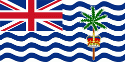
The only inhabitants are British and United States military personnel, and associated contractors, who collectively number around 3,000 (2018 figures). The forced removal of Chagossians from the Chagos Archipelago occurred between 1968 and 1973. The Chagossians, then numbering about 2,000 people, were expelled by the UK government to Mauritius and Seychelles in order to construct the military base. Today, the exiled Chagossians are still trying to return, saying that the forced expulsion and dispossession was unlawful, but the UK government has repeatedly denied them the right of return. The islands are off-limits to Chagossians, tourists, and the media. -
Barbados
Barbados is an island country in the Lesser Antilles of the West Indies, in the Caribbean region of the Americas, and the most easterly of the Caribbean Islands. It occupies an area of 432 km2 and has a population of about 287,000 (2019 estimate). Its capital and largest city is Bridgetown.
Inhabited by Kalinago people since the 13th century, and prior to that by other Amerindians, Spanish navigators took possession of Barbados in the late 15th century, claiming it for the Crown of Castile. It first appeared on a Spanish map in 1511. The Portuguese Empire claimed the island between 1532 and 1536, but abandoned it in 1620 with their only remnants being an introduction of wild boars for a good supply of meat whenever the island was visited. An English ship, the Olive Blossom, arrived in Barbados on 14 May 1625; its men took possession of the island in the name of King James I. In 1627, the first permanent settlers arrived from England, and Barbados became an English and later British colony. During this period, the colony operated on a plantation economy, relying on the labour of African slaves who worked on the island's plantations. Slavery continued until it was phased out through most of the British Empire by the Slavery Abolition Act 1833. -
Bermuda
Bermuda (historically known as The Bermudas or Somers Isles) is a British Overseas Territory in the North Atlantic Ocean. The Bermuda archipelago consists of 181 islands with a total land area of 54 km2. The closest land outside the territory is in the US state of North Carolina, approximately 1035 km to the northwest.
Bermuda is named after Spanish explorer Juan de Bermúdez, who discovered the archipelago in 1505. The islands have been permanently inhabited since 1612, and, forming part of British America, became a crown colony in 1684. The first African slaves arrived in 1616, but as the slave trade ceased by the end of the 17th century, the colony developed into a base for merchants, privateers, and the Royal Navy. More recently, tourism has been a significant contributor to Bermuda's economy. After World War II the territory became an offshore financial centre and tax haven. -
British Virgin Islands
The British Virgin Islands (BVI), officially the Virgin Islands, are a British Overseas Territory in the Caribbean, to the east of Puerto Rico and the US Virgin Islands and north-west of Anguilla. The islands are geographically part of the Virgin Islands archipelago and are located in the Leeward Islands of the Lesser Antilles and part of the West Indies.
The British Virgin Islands consist of the main islands of Tortola, Virgin Gorda, Anegada and Jost Van Dyke, along with more than 50 other smaller islands and cays. About 16 of the islands are inhabited. The capital, Road Town, is on Tortola, the largest island, which is about 20 km long and 5 km wide. The islands had a population of 28,054 at the 2010 Census, of whom 23,491 lived on Tortola; current estimates put the population at 35,802 (July 2018). -
Caribbean Netherlands
The Caribbean Netherlands (Caribisch Nederland, ) are the three public bodies of the Netherlands that are located in the Caribbean Sea. They consist of the islands of Bonaire, Sint Eustatius and Saba, although the term "Caribbean Netherlands" is sometimes used to refer to all of the islands in the Dutch Caribbean. In legislation, the three islands are also known as Bonaire, Sint Eustatius and Saba or the BES islands (an acronym of their names). The islands are currently classified as public bodies in the Netherlands and as overseas countries and territories of the European Union; thus, European Union law does not automatically apply.
Bonaire (including the islet of Klein Bonaire) is one of the Leeward Antilles and is located close to the coast of Venezuela. Sint Eustatius and Saba are in the main Lesser Antilles group and are located south of Sint Maarten and northwest of Saint Kitts and Nevis. The Caribbean Netherlands has a population of 25,157 as of January 2019. -
El Salvador
El Salvador (, meaning "The Saviour"), officially the Republic of El Salvador (República de El Salvador), is a country in Central America. It is bordered on the northeast by Honduras, on the northwest by Guatemala, and on the south by the Pacific Ocean. El Salvador's capital and largest city is San Salvador. The country's population in 2023 was estimated to be 6.5 million.
Among the Mesoamerican nations that historically controlled the region are the Lenca (after 600 AD), the Mayans, and then the Cuzcatlecs. Archaeological monuments also suggest an early Olmec presence around the first millennium BC. In the beginning of the 16th century, the Spanish Empire conquered the Central American territory, incorporating it into the Viceroyalty of New Spain ruled from Mexico City. However the Viceroyalty of New Spain had little to no influence in the daily affairs of the isthmus, which was colonized in 1524. In 1609, the area was declared the Captaincy General of Guatemala by the Spanish, which included the territory that would become El Salvador until its independence from Spain in 1821. It was forcibly incorporated into the First Mexican Empire, then seceded, joining the Federal Republic of Central America in 1823. When the federation dissolved in 1841, El Salvador became a sovereign state, then formed a short-lived union with Honduras and Nicaragua called the Greater Republic of Central America, which lasted from 1895 to 1898. -
Haiti
Haiti (French: Haïti ; Ayiti ), officially the Republic of Haiti (République d'Haïti; Repiblik d Ayiti), and formerly known as Hayti, is a country located on the island of Hispaniola in the Greater Antilles archipelago of the Caribbean Sea, east of Cuba and Jamaica, and south of The Bahamas and the Turks and Caicos Islands. It occupies the western three-eighths of the island which it shares with the Dominican Republic. To its south-west lies the small Navassa Island, which is claimed by Haiti but is disputed as a United States territory under federal administration. Haiti is 27750 km2 in size, the third largest country in the Caribbean by area, and has an estimated population of 11.4 million, making it the most populous country in the Caribbean. The capital is Port-au-Prince.
The island was originally inhabited by the indigenous Taíno people, who originated in South America. The first Europeans arrived on 5 December 1492 during the first voyage of Christopher Columbus, who initially believed he had found India or China. Columbus subsequently founded the first European settlement in the Americas, La Navidad, on what is now the northeastern coast of Haiti. The island was claimed by Spain and named La Española, forming part of the Spanish Empire until the early 17th century. However, competing claims and settlements by the French led to the western portion of the island being ceded to France in 1697, which was subsequently named Saint-Domingue. French colonists established lucrative sugarcane plantations, worked by vast numbers of slaves brought from Africa, which made the colony one of the richest in the world. -
Panama
Panama (, ; Panamá ), officially the Republic of Panama (República de Panamá), is a transcontinental country spanning the southern part of North America and the northern part of South America. It is bordered by Costa Rica to the west, Colombia to the southeast, the Caribbean Sea to the north, and the Pacific Ocean to the south. Its capital and largest city is Panama City, whose metropolitan area is home to nearly half the country's million people.
Panama was inhabited by indigenous tribes before Spanish colonists arrived in the 16th century. It broke away from Spain in 1821 and joined the Republic of Gran Colombia, a union of Nueva Granada, Ecuador, and Venezuela. After Gran Colombia dissolved in 1831, Panama and Nueva Granada eventually became the Republic of Colombia. With the backing of the United States, Panama seceded from Colombia in 1903, allowing the construction of the Panama Canal to be completed by the United States Army Corps of Engineers between 1904 and 1914. The 1977 Torrijos–Carter Treaties agreed to transfer the canal from the United States to Panama on December 31, 1999. The surrounding territory was first returned in 1979. -
Turks and Caicos Islands
The Turks and Caicos Islands (abbreviated TCI; and ) are a British Overseas Territory consisting of the larger Caicos Islands and smaller Turks Islands, two groups of tropical islands in the Lucayan Archipelago of the Atlantic Ocean and northern West Indies. They are known primarily for tourism and as an offshore financial centre. The resident population in July 2021 was put at 57,196, making it the third-largest of the British overseas territories by population.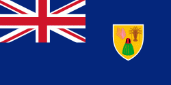
The islands are southeast of Mayaguana in the Bahamas island chain and north of the island of Hispaniola (Haiti and the Dominican Republic). Grand Turk (Cockburn Town), the capital since 1766, is situated on Grand Turk Island about 1042 km east-southeast of Miami, United States. They have a total land area of 430 km2. -
United States
The United States of America (U.S.A. or USA), commonly known as the United States (U.S. or US) or America, is a country primarily located in North America. It consists of 50 states, a federal district, five major unincorporated territories, nine Minor Outlying Islands, and 326 Indian reservations. The United States is the world's third-largest country by both land and total area. It shares land borders with Canada to its north and with Mexico to its south and has maritime borders with the Bahamas, Cuba, Russia, and other nations. With a population of over 333 million, it is the most populous country in the Americas and the third most populous in the world. The national capital of the United States is Washington, D.C., and its most populous city and principal financial center is New York City.
Indigenous peoples have inhabited the Americas for thousands of years. Beginning in 1607, British colonization led to the establishment of the Thirteen Colonies in what is now the Eastern United States. They quarreled with the British Crown over taxation and political representation, leading to the American Revolution and proceeding Revolutionary War. The United States declared independence on July 4, 1776, becoming the first nation-state founded on Enlightenment principles of unalienable natural rights, consent of the governed, and liberal democracy. The country began expanding across North America, spanning the continent by 1848. Sectional division surrounding slavery in the Southern United States led to the secession of the Confederate States of America, which fought the remaining states of the Union during the American Civil War (1861–1865). With the Union's victory and preservation, slavery was abolished nationally by the Thirteenth Amendment. -
United States Virgin Islands
The United States Virgin Islands, officially the Virgin Islands of the United States, are a group of Caribbean islands and an unincorporated and organized territory of the United States. The islands are geographically part of the Virgin Islands archipelago and are located in the Leeward Islands of the Lesser Antilles to the east of Puerto Rico and west of the British Virgin Islands.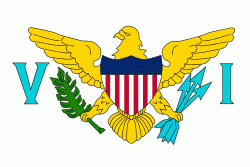
The U.S. Virgin Islands consist of the main islands of Saint Croix, Saint John, and Saint Thomas and 50 other surrounding minor islands and cays. The total land area of the territory is 133.73 sqmi. The territory's capital is Charlotte Amalie on the island of St. Thomas. -
American Samoa
American Samoa (Amerika Sāmoa, ; also Amelika Sāmoa or Sāmoa Amelika) is an unincorporated territory of the United States located in the South Pacific Ocean, southeast of the island country of Samoa. Centered on -14.3°N, -170.7°W, it is east of the International Date Line and the Wallis and Futuna Islands, west of the Cook Islands, north of Tonga, and some 500 km south of Tokelau. American Samoa is the southernmost territory of the United States and one of two U.S. territories south of the Equator, along with the uninhabited Jarvis Island.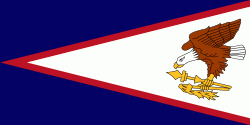
American Samoa consists of five main islands and two coral atolls; the largest and most populous island is Tutuila, with the Manuʻa Islands, Rose Atoll and Swains Island also included in the territory. All islands except for Swains Island are part of the Samoan Islands, The total land area is 199 sqkm, slightly more than Washington, D.C. As of 2022, the population of American Samoa is approximately 45,443 people, of whom the vast majority are indigenous ethnic Samoans. Most American Samoans are bilingual and can speak English and Samoan fluently. -
East Timor
East Timor, also known as Timor-Leste , officially the Democratic Republic of Timor-Leste, is a country in Southeast Asia. It comprises the eastern half of the island of Timor, of which the western half is administered by Indonesia, the exclave of Oecusse on the island's north-western half, and the minor islands of Atauro and Jaco. Australia is the country's southern neighbour, separated by the Timor Sea. The country's size is 14874 km2. Dili is its capital and largest city.
East Timor came under Portuguese influence in the sixteenth century, remaining a Portuguese colony until 1975. Internal conflict preceded a unilateral declaration of independence and an Indonesian invasion and annexation. Resistance continued throughout Indonesian rule, and in 1999 a United Nations–sponsored act of self-determination led to Indonesia relinquishing control of the territory. On 20 May 2002, as Timor-Leste, it became the first new sovereign state of the 21st century. That same year, relations with Indonesia were established and normalized, with Indonesia also supporting East Timor's accession into ASEAN. -
Federated States of Micronesia
The Federated States of Micronesia (abbreviated FSM) is an island country in Oceania. It consists of four states—from west to east, Yap, Chuuk, Pohnpei and Kosrae—that are spread across the western Pacific. Together, the states comprise around 607 islands (a combined land area of approximately 702 km2) that cover a longitudinal distance of almost 2700 km just north of the equator. They lie northeast of Indonesia and Papua New Guinea, south of Guam and the Marianas, west of Nauru and the Marshall Islands, east of Palau and the Philippines, about 2900 km north of eastern Australia, 3,400 km southeast of Japan, and some 4000 km southwest of the main islands of the Hawaiian Islands.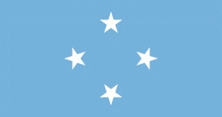
While the FSM's total land area is quite small, the country's waters occupy nearly 3 e6km2 of the Pacific Ocean, giving the country the 14th-largest exclusive economic zone in the world. The sovereign island nation's capital is Palikir, located on Pohnpei Island, while the largest city is Weno, located in the Chuuk Atoll. -
Guam
Guam (Guåhan ) is an organized, unincorporated territory of the United States in the Micronesia subregion of the western Pacific Ocean. Guam's capital is Hagåtña, and the most populous village is Dededo. It is the westernmost point and territory of the United States, reckoned from the geographic center of the U.S.. In Oceania, Guam is the largest and southernmost of the Mariana Islands and the largest island in Micronesia.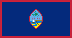
People born on Guam are American citizens but are politically disenfranchised, having no vote in the United States presidential elections while residing on Guam. Guam delegates to the United States House of Representatives have no vote on the floor. Indigenous Guamanians are the Chamoru, historically known as the Chamorro, who are related to the Austronesian peoples of Malay archipelago, the Philippines, Taiwan, and Polynesia. But unlike most of its neighbors, Chamorro language is not classified as a Micronesian or Polynesian language. Rather, like Palauan, it possibly constitutes an independent branch of the Malayo-Polynesian language family. As of 2022, Guam's population is 168,801. Chamorros are the largest ethnic group, but a minority on the multi-ethnic island. The territory spans 210 mi2 and has a population density of 775 /mi2. The Chamorro people settled the island approximately 3,500 years ago. Portuguese explorer Ferdinand Magellan, while in the service of Spain, was the first European to visit the island on March 6, 1521. Guam was colonized by Spain in 1668. Between the 16th and 18th centuries, Guam was an important stopover for the Spanish Manila Galleons. During the Spanish–American War, the United States captured Guam on June 21, 1898. Under the 1898 Treaty of Paris, Spain ceded Guam to the U.S. effective April 11, 1899. -
Marshall Islands
The Marshall Islands (Ṃajeḷ), officially the Republic of the Marshall Islands (Aolepān Aorōkin Ṃajeḷ), is an island country near Guam in the Pacific Ocean, slightly west of the International Date Line. Geographically, the country is part of the larger island group of Micronesia.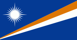
The country's population of 42,050 people (at the 2021 World Bank Census ) is spread out over five islands and 29 coral atolls, comprising 1,156 individual islands and islets. The capital and largest city is Majuro. It has the largest portion of its territory composed of water of any sovereign state, at 97.87%. The islands share maritime boundaries with Wake Island to the north, Kiribati to the southeast, Nauru to the south, and the Federated States of Micronesia to the west. About 52.3% of Marshall Islanders (27,797 at the 2011 Census) live on Majuro. In 2016, 73.3% of the population were defined as being "urban". The UN also indicates a population density of 295 PD/km2, and its projected 2020 population is 59,190. -
Northern Mariana Islands
The Northern Mariana Islands, officially the Commonwealth of the Northern Mariana Islands (CNMI; Sankattan Siha Na Islas Mariånas; Commonwealth Téél Falúw kka Efáng llól Marianas), is an unincorporated territory and commonwealth of the United States consisting of 14 islands in the northwestern Pacific Ocean. The CNMI includes the 14 northernmost islands in the Mariana Archipelago; the southernmost island, Guam, is a separate U.S. territory. The Northern Mariana Islands were listed by the United Nations as a non-self governing territory until 1990.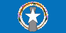
The United States Department of the Interior cites a landmass of 183.5 sqmi. According to the 2020 United States Census, 47,329 people were living in the CNMI at that time. The vast majority of the population resides on Saipan, Tinian, and Rota. The other islands of the Northern Marianas are sparsely inhabited; the most notable among these is Pagan, which for various reasons over the centuries has experienced major population flux, but formerly had residents numbering in the thousands. -
Palau
Palau, officially the Republic of Palau and historically Belau, Palaos or Pelew, is an island country and microstate in the western Pacific. The republic consists of approximately 340 islands and connects the western chain of the Caroline Islands with parts of the Federated States of Micronesia. It has a total area of 466 km2. The most populous island is Koror, home to the country's most populous city of the same name. The capital Ngerulmud is located on the nearby island of Babeldaob, in Melekeok State. Palau shares maritime boundaries with international waters to the north, the Federated States of Micronesia to the east, Indonesia to the south, and the Philippines to the northwest.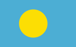
The country was originally settled approximately 3,000 years ago by migrants from Maritime Southeast Asia. Palau was first drawn on a European map by the German missionary Paul Klein based on a description given by a group of Palauans shipwrecked on the Philippine coast on Samar. Palau islands were made part of the Spanish East Indies in 1885. Following Spain's defeat in the Spanish–American War in 1898, the islands were sold to Germany in 1899 under the terms of the German–Spanish Treaty, where they were administered as part of German New Guinea. After World War I, the islands were made a part of the Japanese-ruled South Seas Mandate by the League of Nations. During World War II, skirmishes, including the major Battle of Peleliu, were fought between American and Japanese troops as part of the Mariana and Palau Islands campaign. Along with other Pacific Islands, Palau was made a part of the United States-governed Trust Territory of the Pacific Islands in 1947. Having voted in a referendum against joining the Federated States of Micronesia in 1978, the islands gained full sovereignty in 1994 under a Compact of Free Association with the United States. -
United States Minor Outlying Islands
The United States Minor Outlying Islands is a statistical designation defined by the International Organization for Standardization's ISO 3166-1 code. The entry code is ISO 3166-2:UM. The minor outlying islands and groups of islands consist of eight United States insular areas in the Pacific Ocean (Baker Island, Howland Island, Jarvis Island, Johnston Atoll, Kingman Reef, Midway Atoll, Palmyra Atoll, and Wake Island) and one in the Caribbean Sea (Navassa Island).
In 1936, a colonization program began to settle Americans on Baker, Howland, and Jarvis, but all three islands were evacuated in 1942 as a result of World War II.